
Bernards Township ZIP Code Coverage
The township's official ZIP material identifies four postal codes serving Bernards Township addresses. They are useful starting labels for a letter, a parcel search, or a family-history address, but none is a municipal line. Basking Ridge, Liberty Corner, Lyons, and Far Hills can appear as postal designations while the legal municipality and parcel record need separate confirmation. The coverage below keeps the postal role clear and avoids adding nearby codes that official township material does not list.
| ZIP | Areas Covered | Post Office | Notes |
|---|---|---|---|
| 07920 | Basking Ridge and addresses using the Basking Ridge postal designation | Basking Ridge/Village station | The municipal building uses Basking Ridge 07920; check the situs municipality separately. |
| 07931 | Township addresses using the Far Hills postal designation, including parts of the broader Bernards area | Far Hills Post Office | A Far Hills postal city does not rule out a Bernards Township parcel. |
| 07938 | Liberty Corner | Liberty Corner Post Office | Liberty Corner is a community and postal designation, not a separate municipality. |
| 07939 | Lyons | Lyons Post Office | Use the municipal parcel and road key because Lyons can be confused with nearby postal communities. |
Official research does not support treating 07921, 07924, 08807, or 08836 as Bernards Township coverage. Those codes may be nearby, yet a nearby label is not proof that an address belongs in the township. The ZIP code directory is most reliable when it records the postal city alongside the legal municipality, county, street address, and parcel identifier.
Bernards Township Postal Communities
Bernards Township is an unincorporated township, not one incorporated city center. Township materials use Basking Ridge for municipal offices and recognize Basking Ridge, Liberty Corner, and Lyons as local communities. The township directions also place municipal locations in Basking Ridge and Liberty Corner. Those useful place names describe local orientation, while the assessment roll and county parcel map determine the government geography tied to an address.
07931 is the clearest caution. A township address may carry a Far Hills postal designation, so a searcher should not discard a result merely because the postal city differs from Bernards Township. In the same way, a ZIP may reach beyond a township edge. Keep both labels in notes, then use the parcel record's municipality field to settle the jurisdiction.
For Bernards Township election and parcel work, the local name on the envelope is only one part of the record. The election-district map uses Basking Ridge and Liberty Corner landmarks, while the Board of Elections request process relies on municipality or voting district. A Bernards Township property search should therefore retain the postal city for address matching but use the municipality, parcel key, and official district when a government record has to be matched. This preserves the useful community label without mistaking it for a boundary.
Bernards Township ZIP Code Post Office
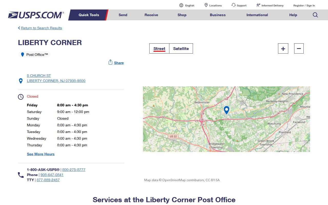
Liberty Corner's 07938 entry has the strongest captured post-office detail. The USPS Liberty Corner location record lists the office at 8 Church Street, Liberty Corner, NJ 07938-9800, telephone 908-647-0841, with weekday hours of 8:00 a.m. to 4:30 p.m. and Saturday hours of 9:00 a.m. to noon. That record confirms a postal location and ZIP-plus-four service context. It does not establish who receives mail at any address.
The official USPS listing shows the Liberty Corner post-office result used for this local ZIP reference.
For address work, a ZIP-plus-four can refine delivery routing, but it does not replace the street address, legal municipality, or parcel key used by Somerset records.
Bernards Township ZIP Search Limits
No local public portal documented in the research supports a complete resident search by ZIP. The Bernards WIPP assessment record includes the owner's mailing city, state, and ZIP as a result field, but the captured model does not establish a ZIP-wide search filter. The county GIS viewer supports address, block and lot, and property-class queries, not a documented ZIP filter. AcclaimWeb indexes recorded land instruments by legal and document fields rather than by postal code.
| Official channel | ZIP role | Useful record key | Documented limit |
|---|---|---|---|
| Bernards WIPP | Owner mailing ZIP appears in results | Situs address, block, lot | No verified ZIP-wide filter |
| Somerset Tax Parcel Viewer | Use ZIP only after an address is known | PAMS_PIN, municipality, block, lot, QCODE | No documented ZIP query or ZIP layer |
| AcclaimWeb | Postal code is not an index field | Legal description, block/lot, book/page | Name and instrument search, not ZIP search |
| Board of Elections request | Requestor supplies a contact ZIP | Municipality or voting district | Form does not list ZIP as request geography |
The state voter-status service is person-based, not a ZIP browse. A county voter-file request has political-purpose limits and protected fields or addresses remain withheld. Postal geography can narrow an address check, but it does not open a ZIP-wide voter list.
Trace a Bernards Township ZIP Address
A ZIP code directory is most useful as the first line of an address workflow, not as a people list. Begin with an exact mailing address and postal code. Confirm the delivery label through USPS, then move to the county parcel map to identify the legal municipality and parcel. The resulting block and lot are more durable than a postal label when a street name, postal city, or address format changes.
- Verify the mailing address and postal code with USPS, retaining the exact street spelling and ZIP-plus-four when available.
- Use the Somerset parcel viewer to confirm the address, municipality, PAMS_PIN, block, lot, QCODE, and situs location.
- Search WIPP with the address or legal parcel fields and record the owner mailing field separately from the situs address.
- Use the block, lot, legal description, or deed book and page in AcclaimWeb when a recorded land instrument is needed.
Once the postal area has narrowed the address, the Bernards Township street directory provides the fuller street-by-street record trail. A mailing ZIP can assist a lookup, but the address, parcel, and recorded-description sequence keeps the result anchored to the right place.
Bernards Township ZIP Code Boundaries
Postal boundaries and township limits answer different questions. The Postal Service routes mail, while the township, county, and election offices organize records by legal jurisdiction, parcel, municipality, or voting district. A Basking Ridge, Liberty Corner, Lyons, or Far Hills line on an envelope is therefore not a substitute for the municipality on the parcel record. The official election request form can use municipality or voting district, not a ZIP geography.
There is no verified official street-by-street ZIP map, split or realignment chronology, annexation list, or address-renumbering history for the township in the researched sources. The responsible method is to record the current address, an older spelling if one appears, block and lot, tax-map number, legal description, and nearest intersection. A postal code alone cannot bridge a historical address change.
Bernards Township ZIP Code Terms
Postal shorthand can hide the difference between routing, delivery, and land records. These terms help keep a Bernards Township ZIP search from turning a mailing detail into an ownership or residency claim.
- ZIP code
- A Postal Service routing code. It can cross municipal lines and does not define a parcel or voting district.
- ZIP+4
- The added four digits refine delivery routing within a ZIP code. They are not a legal address boundary.
- PO-box ZIP
- A ZIP used for post-office box delivery. Research did not identify one as a Bernards Township coverage category.
- Unique ZIP
- A code assigned for a single organization or delivery purpose. Research did not verify one for the township.
- Carrier route
- A mail-delivery sequence used by USPS. It does not identify a municipal boundary or the people at each address.
Bernards Township Parcel Keys
Somerset's PAMS_PIN combines county and municipal coding with block, lot, and qualification information. The GIS layer also exposes MUN, Municipality, BLOCK, LOT, and QCODE. Preserve those values with the postal city and ZIP, since a property can be more reliably matched across record systems by legal parcel fields than by a mailing label.
MOD-IV calls the physical property location the situs. It separately carries the owner's mailing address, which may be elsewhere and should not be treated as proof of presence at the parcel. AcclaimWeb adds the legal description and deed book/page. The New Jersey parcel-data page likewise warns that parcel data are not a survey or legal ownership determination.
Note: Preserve the postal city, legal municipality, ZIP, PAMS_PIN, block, lot, and QCODE together when comparing Bernards Township address results.
Bernards Township ZIP Geography
The four official codes are a practical geography layer for mail and local orientation. They do not divide the township into four resident rolls. The township's Basking Ridge, Liberty Corner, Lyons, and Far Hills postal labels are useful search terms for addresses, newspapers, planning material, and historical references, but each result still needs its legal municipality and parcel context.
That small distinction prevents a common local error: confusing Bernards Township with a nearby place because the mailing city is different. For family history, property curiosity, or a records request, keep the postal label as part of the address history and let the relevant custodian's parcel or jurisdiction field control the conclusion.